![The Big Oak at Big Oak Flat about 1870. [Frontispiece to 1959 printing]](images/big_oak_1870.jpg)
[click to enlarge]
The Big Oak at Big Oak Flat about 1870.
[Frontispiece to 1959 printing]
| Online Library: | Title | Author | California | Geology | History | Indians | Muir | Mountaineering | Nature | Management |
Yosemite > Library > Big Oak Flat Road > 1959 Photographs >
Editor’s note: The following photographs appeared in the 1959 printing that were not in the first (1955) printing—dea.
|
[click to enlarge] The Big Oak at Big Oak Flat about 1870. [Frontispiece to 1959 printing] |

Courtesy of Helen Weber Kennedy
[click to enlarge] Home of Marie Charles Weber, Stockton. |
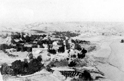
[click to enlarge] Knight’s Ferry probably in the 1870’s. The original bridge was destroyed by the flood of 1862 and rebuilt in 1863. |

[click to enlarge] Certificate of the Yo Semite Turnpike Road Company, issued in 1869. |

[click to enlarge] Keystone House, about 1890. Billy Fields in center. |

Collum
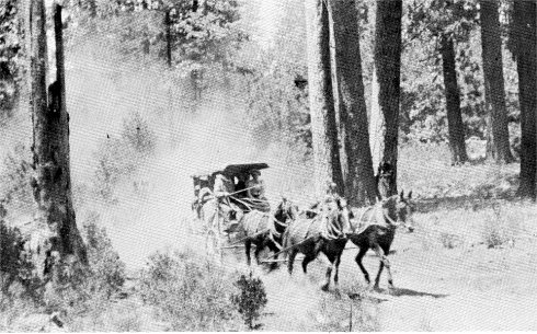
[click to enlarge] Brunson’s Stage and Freighter at Keystone House, 1898. Mr. and Mrs. Horatio Brunson at right foreground. |

Perkins
[click to enlarge] O’Brynes Ferry Bridge. The construction of the Tulloch Dam and flooding of reservoir destroyed this landmark in 1958. |
Courtesy of Grace Morris
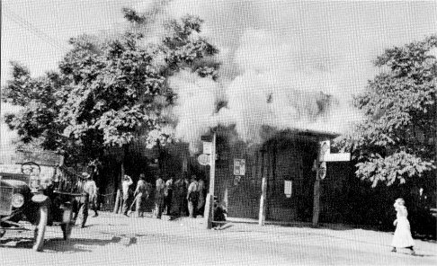
[click to enlarge] Burning of the Morris Store, Chinese Camp, 1918. |

Courtesy of George Egling
[click to enlarge] Freighter on Moffitt’s Bridge, Big Oak Flat Road, descending hill on left. Jacksonville in distance, center. |
Courtesy of Pitts Studio
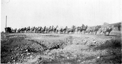
[click to enlarge] 26 Mule Team and Wagon, Tuolumne County. |

Courtesy of Edwin Harper
[click to enlarge] Big Oak Flat after the fire of 1863. Trunk of Big Oak stands at right. |

Courtesy of Celia Crocker Thompson [click to enlarge]Chamberlain and Chaffie at their mine near Second Garrote, 1898. |

Holmes [click to enlarge]James A. Chaffie and Jason P. Chamberlain at home, Second Garrote, 1892. |

[click to enlarge] Office of Golden Rock Water Company in the early 1900’s. This is now the Sugar Pine Lodge. |
Lumsden
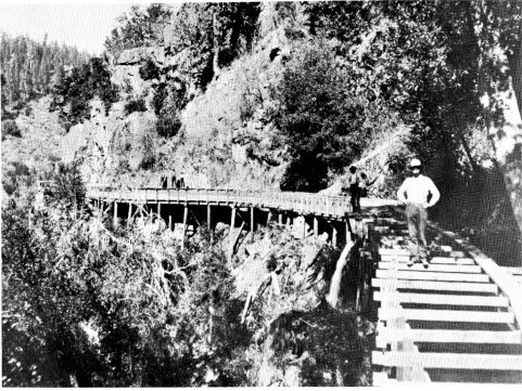
[click to enlarge] Flume of the Golden Rock Water Company at Hardin’s Mill. |

Perkins
[click to enlarge] Caleb Dorsey’s Sawmill, about 1885. Water for the mill was purchased from the Golden Rock Water Company. |

Celia Crocker Thompson
[click to enlarge] Covered Bridge over the South Fork of the Tuolumne River, 1906. |
Lukens, courtesy of Pitts Studio
[click to enlarge] Stage on Big Oak Flat Road near crest of Hardin Hill, 1888. Ed McGowan, driver. |
Celia Crocker Thompson
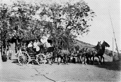
[click to enlarge] Stage “Yosemite” at Priest’s Hotel, about 1900. |

Celia Crocker Thompson
[click to enlarge] Crocker’s Station, 1897. |

Yosemite Museum
[click to enlarge] Stage on the Big Oak Flat Road. |
Celia Crocker Thompson
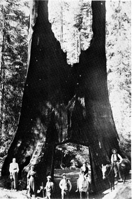
[click to enlarge] The Dead Giant, Tuolumne Grove, 1894. |

Celia Crocker Thompson
[click to enlarge] Crane Flat, 1901. Building with porch, Goblin’s Hotel; Billy Hurst’s Saloon in front of team. |

Celia Crocker Thompson
[click to enlarge] Curtin’s “Cow Camp” at Gin Flat on the Big Oak Flat Road, 1901. |

Celia Crocker Thompson
[click to enlarge] Woods’s at Tamarack Flat, 1901 |

[click to enlarge] “The Yosemite Flyer,” Jerome Martin, driver. |

Celia Crocker Thompson
[click to enlarge] Opening of the Big Oak Flat Road into Yosemite Valley, July 17, 1874. |

Celia Crocker Thompson
[click to enlarge] Mr. and Mrs. J. M. Hutchings at Crocker’s Station, 1902. Mr. Hutchings was killed a few hours later when his frightened horses ran uncontrolled down the zigzags of the Big Oak Flat Road. |

[click to enlarge] Down into Yosemite Valley. El Capitan in background. About 1907. |

[Julias T.] Boysen
[click to enlarge] On the zigzags above Yosemite Valley [1903]. These were obliterated by rock slides in October 1942. [Editor’s note: the first (1955) printing came with a sepia-tone print of this photograph—dea.] |

Taber
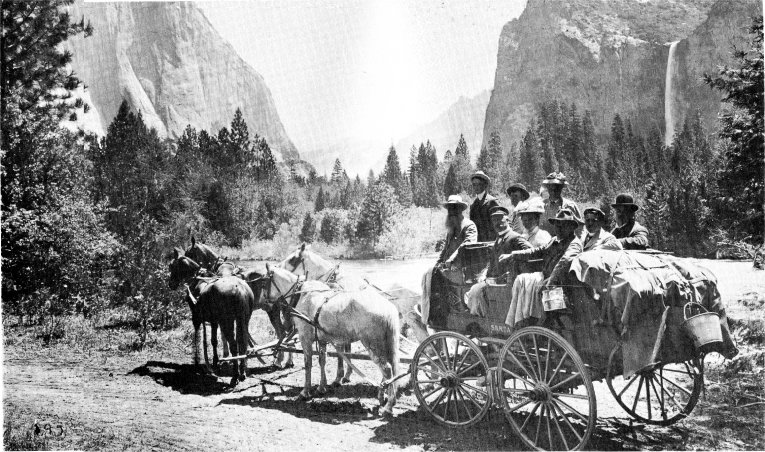
[click to enlarge] Approaching the Stoneman House, Yosemite Valley, 1895. Yosemite Falls at left. |
[click to enlarge] At the “Gates of the Valley.” |
| Online Library: | Title | Author | California | Geology | History | Indians | Muir | Mountaineering | Nature | Management |
http://www.yosemite.ca.us/library/big_oak_flat_road/1959_photographs.html
![[click to enlarge]](images/brunsons_stage.png)