
[click to enlarge]
Sketch 1. Northern Areas.
| Online Library: | Title | Author | California | Geology | History | Indians | Muir | Mountaineering | Nature | Management |
Yosemite > Library > Climber’s Guide to the High Sierra > Area Covered >
Next: Sierra Camping & Climbing • Contents • Previous: Introduction
THE GENERAL area covered is the Sierra Nevada between Bond Pass on the north and Army and Franklin passes on the south. Usually only peaks above 10,000 feet elevation are included, but a notable exception is made for the Yosemite Valley, where many rock climbs to points 6,000 to 9,000 feet in elevation are described. Throughout, peaks and climbs have been selected on the basis of interest to the climber or because of their prominence in a region, rather than by definition in terms of a minimum of so many hundreds of feet above the nearest saddle. This choice has been arbitrary and has left out many small peaks which may ultimately attract attention. On the other hand, the peaks included are quite numerous, and many are listed which can be very easily climbed.
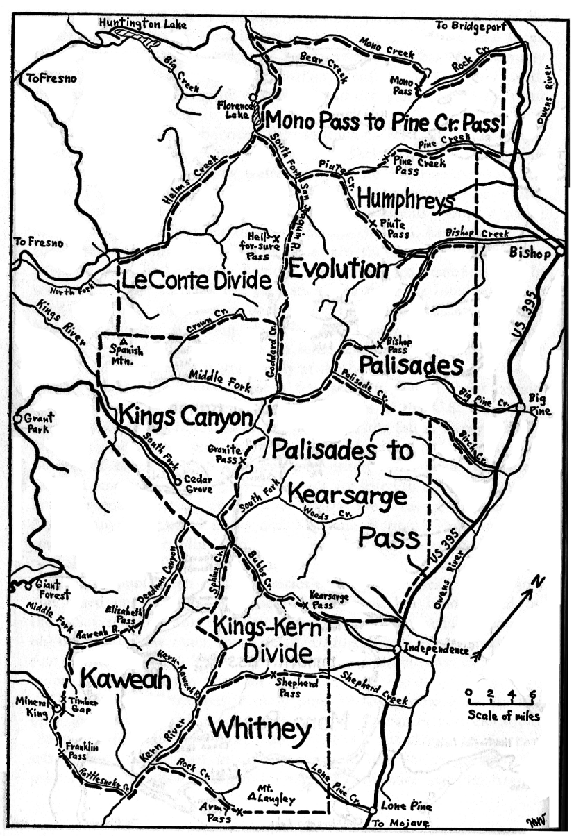
The whole area is subdivided into sections marked off by the major passes across the Sierra Crest, as shown in Sketches 1 and 2. Dividing lines between sections follow water courses, with a few exceptions such as the Tioga Pass Road. Within sections there are certain areas which, because of their isolation or because of their accessibility from a single base, or because of unusual attractiveness for climbers, have come to be considered as units. Such, for instance, are the Sawtooth Ridge, the Palisades, and the Evolution Region. These areas are treated separately within the major sections. For each such area there are usually given a brief description, some history of the climbing, routes of access, information on campsites, a listing of passes and knapsack routes, and the routes and records for the peaks. In some sections general information for the individual areas is given only at the head.
Sketch maps are included for a few sections. These show certain features or routes not on the topographic maps of the U.S. Geological Survey, but are not intended as substitutes for the latter. Every climber will need the topographic maps to aid in identification of peaks and finding of routes. The Sierra region of interest has been completely mapped on a scale of 1:125,000. The maps are listed in the bibliography. Larger sheets made up of the above show the areas of Sequoia and Kings Canyon National Parks and Yosemite National Park and thus cover much of the High Sierra. Climbers should be warned against possible errors in all of these old maps.
Recently, publication of a new series of maps, on a scale of 1:62,500, and based on stereophotographic aerial surveys, has been started by the U.S. Geological Survey. These new maps are more reliable than the old ones and show much more detail. Unfortunately only a small portion of the total High Sierra region has so far been covered by the new maps, but within a few years all will have been.
The existence of two sets of maps poses certain problems in making up a guidebook which is of necessity based on names and elevations shown on the maps. For most places the elevations shown on the two sets of maps differ, yet for unnamed peaks the elevations serve as primary identification, being followed by the distance in miles from a
|
[click to enlarge] Sketch 1. Northern Areas. |
[click to enlarge] Sketch 2. Southern Areas. |
Next: Sierra Camping & Climbing • Contents • Previous: Introduction
| Online Library: | Title | Author | California | Geology | History | Indians | Muir | Mountaineering | Nature | Management |
http://www.yosemite.ca.us/library/climbers_guide/area_covered.html