
[click to enlarge]
| Online Library: | Title | Author | California | Geology | History | Indians | Muir | Mountaineering | Nature | Management |
Yosemite > Library > François Matthes > François Emile Matthes >
Next: Winds of the Yosemite Valley • Contents • Previous: Table of Contents
|
[click to enlarge] |
François Emile and Gerard Henrik Matthes, twin brothers, were born in Amsterdam, Holland, March 16, 1874. Their parents both belonged to old, distinguished families of the Netherlands.
Willem Ernst Matthes, the father, was a well-to-do merchant, member of the firm of Matthes and Bormeester, dealers in colonial products such as rubber, indigo, and hemp, the firm that had the contract to furnish India rubber for the first transatlantic cable, laid in 1866. He had traveled widely throughout Europe and was a man of broad culture and many interests. He was the founder and first president of an academy of arts and sciences, known as “Felix Meritis,” which was inaugurated by William III of Orange, King of Holland; and he was also a director of the “Natura Artis Magistra,” the famous Amsterdam Zoological Gardens. Fond of horseback riding, he owned several saddle horses, was one of the organizers of the riding academy of Amsterdam, and, as a Lieutenant Colonel in the National Guard, commanded the artillery unit of Amsterdam.
The mother, Jonkvrouw Johanna Suzanna Matthes, nee van der Does de Bije, was a delicate but singularly beautiful and refined woman, with a keen mind and a flair for history. She was the youngest of thirteen children, six brothers and seven sisters, who were brought up in the old university town of Leiden, and mingled in court circles at the Hague. The clan, van der Does, to which she belonged, was of the nobility of Holland and well deserved the surname of “de Bije” the bees). Johanna—Nancy as she was usually called— was a lineal descendant of Janus van der Does, the patriot Commandant of the City of Leiden in its epic resistance to the Spaniards in the siege of 1574.
The Matthes home, on the Heeren Gracht near the corner of Vijzel Straat, was a stately mansion facing one of Amsterdam’s canals. It was the center of numerous social affairs, dazzling with decorations, uniforms, and sabers. The little twins could peek at all this splendor but themselves had no part in it. However, life-size marble busts of the boys, made when they were five, graced the banquet hall of the home.
Gerard vividly remembers the vacations which the family spent at Trouville and Biarritz, France. At Biarritz, where the ocean tides were dangerously high, the shore was lined with sheer cliffs, and the beach was strewn with boulders. The twins, then eight, discovered that these boulders contained fossils, and they proceeded to chisel them out with little hammers. Their collection became so big (and heavy) that, at time of departure, the mother refused to pack it in their

[click to enlarge] Willem Ernst Matthes |
François Emile Matthes at age six
[click to enlarge] 
|
When about eight years of age, the twins began to be troubled with malaria. The disease was common in Amsterdam, but since its cause was not understood no measures were taken to check the breeding of mosquitoes in the canals. The family doctor, Van Wezel, an able man for his time, recommended for the boys a sojourn of several years in the Alps, which were known to be malaria-free. Accordingly, when the twins were nearly ten, it was decided that the mother should take them to Switzerland, there to lay the foundations of health and cosmopolitan education,—a decision which, Gerard affirms, was a turning point in their lives. As a result of it, François, though born below the level of the sea, became a lover of the mountains and gave most of his life to their study.

[click to enlarge] Gerard and François, with their mother, about 1886 |
At Courgevaux, a few miles from Lac Morat, the mother found a school suitable for foreigners, and they took residence near by in a wing of the castle of the Count of Pourtal, who was away. It was an enchanting abode, set amidst immaculate, spacious gardens; and the twins thoroughly enjoyed their mile-long walk from the castle to school. In Lac Morat they could see rows of stumps, remnants of the piles which in ancient times supported the homes of the Lake Dwellers. Wading in the lake they found relics of the army of Charles le Temeraire (last Duke of Burgundy), which at this spot was overwhelmed by the Swiss in 1476. From the nearest town, Murten, the boys could hike to the ruins of a Roman amphitheater.
Gerard recalls,
We lived in the castle more than a year. The pupils at school were of all ages and spoke many languages. There were English, Germans, Americans, Italians, a Spaniard, a Greek, and an Egyptian prince, and other nationalities. The young boys were placed under the supervision of the more mature ones; our mentor was a bright young Englishman. He taught us boxing, running races, and playing cricket. We learned to speak French fluently, and picked up a smattering of German (spoken throughout Switzerland) and some English words.
In 1885-1886, when we were eleven, we lived first at Montreux in a first-class hotel overlooking Lake Geneva, and later in a smaller hotel called “Montfleuri,” perched on the steep mountain side and affording gorgeous views of the lake and the snow-capped mountains to the southeast, the Dent-du-Midi. Life at Montfleuri, too, was a joy to us boys. We fell to sketching Lake Geneva, the steamers on it, and the Dent-du-Midi. We learned swimming in the lake near the picturesque Castle of Chilton.
Living half-way up the mountain meant going down to lake level to attend a private school at Territet; where the pupils were mostly English boys. This called for a daily mountaineering stunt. I attribute our capacity for climbing mountains later in life to our excellent lung capacity developed by this daily exercise. We learned to run uphill when chasing butterflies, and climbed to high altitudes to collect rare species. We studied the ways of different kinds of ants.
Father spent a week or two with us each summer. His hobby was mountaineering, and we enjoyed it with him. At Montfleuri our favorite climb was to the top of the nearby Dent de Jaman, 5000 feet above lake level. Father brought us cloth-mounted military maps (General Dufour’s series) which showed all triangulation stations. On the ground these stations were marked by tall white timber pyramids. The maps had no contours, but were beautifully finished with hatchures, which brought out the relief in great detail. Father taught us to read the maps and we learned to locate ourselves. After he left we always carried the maps in our blouses, and roamed about without fear of getting lost.
Becoming “map wise” as boys was to prove of tremendous help to the twins in later years.
Vacations were spent at various alpine resorts. One of these was noted for its fine St. Bernard dogs, and on their expeditions the boys always took one or two of the dogs along. On their final trip to a resort in the Alps, they crossed the border to celebrated Chamonix, in France. Here they visited the great glaciers of Mont Blanc. Standing upon Le Glacier des Bossons, they marveled at the intense blue green of the ice deep down in its crevasses.
Little wonder that, after four years of such idyllic boyhood, frail bodies became strong; bright, inquiring minds were stimulated; and as the twigs were bent the trees inclined.
Themselves patrons and collectors of art, the parents saw to it that from the age of nine on the twins received instruction in drawing with pencil, charcoal, and drawing inks. François revealed a native talent for art which amazed everyone. The boy was fascinated by the work of the American artist, Frederick Remington, which he studied until he, too, became adept at drawing animals, particularly horses. François’ boyhood sketch books have been preserved, and leafing through their pages, crowded with exquisitely drawn horses, in every imaginable pace and attitude, one cannot but wonder whether, had he pursued the career of an artist, he might not have rivaled Remington, or the noted French contemporary painter of animals, Rosa Bonheur. However, the education of the Matthes twins had been planned along quite different lines, as is evident from the fact that, beginning also at the age of nine, they were taught to draw on tracing linen, with use of triangles, T-square, and drawing pens.
In 1887 the twins, now thirteen, procured German grammars and began serious study of the German language. That fall their mother brought them to Frankfurt am Main, in Germany. Here they were left in care of one Professor Goedeke, and in his home shared quarters with four other school boys. Their studies were now continued at the Klingerschule, a technical high school (“Ober-realschule”). Besides German, they received excellent instruction in both French and English, —in accordance with Willem Matthes’ wish that his sons “learn ‘live’ languages thoroughly and skip Latin and Greek.” Gymnastics and out-of-doors sports were also taught, including swimming, in the River Main.

[click to enlarge] |
Refreshing changes from school life were provided by the summer months, when they visited their home in Amsterdam; traveled through France, Germany, and Switzerland; or stayed at Villa Favorita, the summer residence of the family at Baarn (near the beaches and dunes of Holland), or visited at Chateau Einthout, near Brussels, Belgium, the country estate of the Baroness van der Elst, a great friend of the Matthes family for whose deceased husband François Emile had been named. On their trips between Amsterdam and Frankfurt, the boys traveled by train along the Rhine, going down one side and back along the other, so as not to miss any of the fine scenery.
The studies at Frankfurt were intended as preparation for an engineering course at a German university; but after the twins had spent four years in Germany, their plans underwent another momentous change, when fate intervened—in the person of a traveling Harvard professor—and instead, in September 1891 they set out on a long voyage, to Amerika. At the outset of the voyage, a violent storm disabled their ship, so that the adventure all but ended in disaster, but eventually, though days behind schedule, they reached New York harbor. When they sought admission to the Massachusetts Institute of Technology, the semester was already under way, but the president, General Francis A. Walker, becoming interested in the twins, permitted them to take the entrance examinations. These showed them to be far ahead of requirements in modern language and mathematics, and deficient only in American History. They were admitted at once to the civil engineering course, as freshmen, but were excused from taking French and (being foreigners) from military drill.
Thus, in all the strangeness of a foreign land the twins began life anew and in their fourth language, English. With the writing of English they had little difficulty, as they were actually better prepared than most of their American classmates, so thorough had been their instruction at the Ober-realschule; and their rapid progress in the mastery of spoken English is evidenced by the fact that they were soon giving talks to the Civil Engineering Society of the Institute and other groups, on various technical subjects. Some of these subjects, though very familiar to them, must have been novel to their fellow students. François, for instance, spoke on “The Draining of the Zuider Zee” and “The Use of Mattresses in Dike Construction.” Their early training in drawing and drafting now stood them in good stead; François soon became the outstanding draftsman in his class. At the advice of a professor who had formerly been connected with the U. S. Coast and Geodetic Survey, the boys elected the geodetic course, which would prepare them for careers with that Survey.
Both boys became active members of the Agassiz Association of Boston; Gerard, as a senior, was elected president of the society. Their large insect collection from Switzerland they presented to the Museum of Natural History in Boston and, in return, were allowed free use of the museum library. Their interest in entomology continued. François, in autobiographical notes from the period, refers to illustrated talks which he gave to the Agassiz Association and other groups in Boston and elsewhere on “Coleoptera”; “Parasitic Insects”; “Insect Life in Winter”, and other entomological topics.
Their first summer in the United States, 1892, the boys pursued their favorite pastimes—camping, mountaineering, and collecting insects—in the White Mountains. The second summer they were employed by an insurance company to make drawings of the fire-protection devices used in various eastern factories. With their earnings they paid their way to Chicago, to see that city’s first World Fair. The third summer, spent at the M.I.T. field school in the Adirondacks, they learned mapping with plane table and alidade, and, in the Ausable River, measuring stream flow with different kinds of current meters.
General Walker proved their constant warm friend and counselor; Gerard reciprocated by writing the “Military Career of General Walker” (in the Civil War) for the college annual. The busy college years sped swiftly and happily by. In 1895 the twins both graduated with honors, receiving the degree Bachelor of Science, and the next year they proudly became citizens of the United States.
At this point we must separate the twins, Gerard and François. Each went his way to climb to the top of his profession. Gerard distinguished himself in the field of hydrographic engineering (see Who’s Who in America and American Men of Science); François for many years expressed his talent for drawing, as well as for precise, analytical scientific work, in the making of topographic maps. Eventually, however, he became a geomorphologist and a glacial geologist. As the latter specialty came to include the study of existing glaciers it, in turn, led him far into the related fields of meteorology and climatology.
Following graduation, on June 1, 1895, François entered upon the duties of his first position, which was as instrument man and draftsman in the city engineer’s office at Rutland, Vermont, and was assigned to the making of detailed topographic surveys for the city. Exactly one year later he joined the organization with which he was to be connected for fifty-one years: the United States Geological Survey. From June 1 to November 1, 1896, he was traverseman with topographic parties in New York and Vermont. He then became field assistant in Indian Territory (now a section of Oklahoma), part of the time serving as acting chief draftsman, part of the time being in charge of revision work in the field. On April 1, 1898, having passed the federal Civil Service examination, he was advanced to assistant topographer, a grade which qualified him for the larger opportunities now at hand.
In the summer of 1898, the United States was at war with Spain, but pressing domestic projects were under way also. Little-known areas of the West were being mapped by the Geological Survey. Early in the summer, Matthes received his first assignment as a party chief, in connection with surveying the Cloud Peak quadrangle in Wyoming. The lower, western third of the quadrangle had been surveyed by H. S. Wallace in 1897; it remained for Matthes to survey the remainder of the quadrangle, including all the main crest of the Bighorn Mountains, in 1898 and 1899. From Washington he went west by train, arriving, on July 20, 1898, at the frontier town of Sheridan, where he proceeded to organize the personnel and equipment of his party. It was no task for a weakling, either with respect to the exploration of these trackless mountains or the problems involved in the mapping; but the physical difficulties were, of course, simply part of the day’s work. The map was the thing!
Of Matthes’ work as topographer, it has been said that he “contributed notably to the effectiveness of mapping rugged mountain areas,” and that this method, which involved multiple sights through the telescopic alidade and the sketching of provisional form lines, has become standard procedure (Visher). (Prior to about 1935, all the topographic maps produced by the Geological Survey were made with the use of the alidade and plane table.) Matthes’ success as a topographer stemmed not only from mastery of technical principles and methods, and from his skill in drawing, but also from his keen analysis of land forms and his consuming desire to understand them. The Bighorn Mountains provided him with his first opportunity to delineate, with contour lines, the varied patterns of mountain landscapes, especially those resulting from alpine glaciation; and as he brought out the topographic features on his maps he pondered over their origin. Thus, following his field work, in 1899, he rendered a service beyond the call of duty as topographer when, in the evenings, after long days of drafting at the Washington office, he wrote Glacial Sculpture of the Bighorn Mountains, Wyoming. This was his first scientific publication, and it is still a standard reference. In it Matthes distinguished from the land forms sculptured by glaciers other features produced by persistent snow fields, and he applied the now-familiar term “nivation” to the previously unrecognized geomorphic processes which were involved.
From his initial assignment in the Rocky Mountains, Matthes emerged a seasoned topographer of recognized skill, and a first-rate horseman and packer, with experience which was to prove all but indispensable to him in his future work. On July 1, 1899, he was promoted to the rank of full topographer. In the spring of 1900 he made a hydrographic reconnaissance of the Blackfoot Indian Reservation in Montana. There followed a succession of assignments which included two areas in Montana (the Chief Mountain quadrangle and part of the adjacent Browning quadrangle, surveyed in the summers of 1900 and 1901), two areas in Arizona (the Bradshaw Mountains quadrangle, surveyed in the winter of 1900-1901, and the Jerome quadrangle, surveyed in the winter of 1902-1903), and several other areas which, from the standpoint of the topographer, were as difficult and spectacular, and therefore as challenging, as any to be found in the entire Far West.
Matthes, albeit sturdily built, was a man of rather small stature, and there was little in his appearance to suggest his capacity for enduring hardships and strenuous activity of the kind that these assignments necessitated. That he became a master of reconnaissance mapping—first topographic and later geologic, much of it carried out in exceedingly difficult terrain without benefit of roads, or, for that matter, even trails, at a time when modern aids to mapping such as aerial photography were unheard of—may be attributed not only to hardihood and perseverence but also to his consummate skill in planning and executing long pack trips, and to his great resourcefulness in solving the problems posed by exploration in wilderness country.
In the Chief Mountain quadrange, as in the Cloud Peak quadrangle, Matthes found glacial sculpturing illustrated on a grand scale and with remarkable clarity; and there was even better opportunity to study small but interesting existing glaciers. He established stations on a number of the principal summits and determined the elevations of the peaks. It became evident, as the map grew, that what had heretofore been “just Rocky Mountains,” insofar as official Washington knew, was a veritable “Alps.” Conservation was to the fore, enthusiasm grew, and the superb Chief Mountain quadrangle, together with Matthes’ photographic records and his publications, gave telling impetus to the movement which culminated in 1910 in the act of Congress establishing Glacier National Park.
In February 1902 came orders to begin the mapping of the upper half of the Grand Canyon of the Colorado River, in Arizona, the scenically more remarkable section of the canyon which was destined later (1919) to become Grand Canyon National Park. Aside from the difficulties of getting about in, and mapping, some 500 square miles of almost incredibly rugged country—country dissected with labryinthine complexity and traversed by a mile-deep chasm considered impassable—and of maintaining the life of men and animals in a forbidding, practically uninhabited region, largely devoid of usable water supply, the assignment was a staggering undertaking, the full details of which have yet to be told.1 Suffice it to say that the mapping was done wholly by means of the plane table, the Grand Canyon providing, in Matthes’ words, “an extreme test of the efficiency of that instrument.” It was the original intention to publish the maps in 15-minute quadrangles, on the standard scale of 1:62,500 and with 100-foot contour intervals. However, preliminary experimentation convinced Matthes that while his field map, made on the scale of 1:48,000, with 50-foot contour intervals, best expressed the significant topographic elements, this map would not stand reduction to the standard scale. He therefore traced a detail of his field map (delineating Zoroaster Temple) and sent it to Washington, with the recommendation that the Grand Canyon quadrangle be made an exception to usual practice and be published on the scale of 1:48,000, with 50-foot contour intervals. The recommendation was approved. It followed that the field maps had to be drawn with such accuracy and neatness that they could serve, unreduced, as copy for the engraver. This necessitated the most painstaking kind of drafting, first in pencil and later in ink, but as a result the maps were published with the scale and contour interval best adapted to bringing out the distinctive topography of the Grand Canyon.
Matthes began the survey, the first summer, by crossing the canyon with his pack train to the north rim, and working on the high northern plateaus. As the mapping progressed, he studied out through his telescope the details of a remarkably long, straight side canyon, that of Bright Angel Creek, which he recognized as marking the trace of a fault, and along which the cliffs had disintegrated into loose talus. As winter approached, the men hastily built a trail down this talus, while Matthes himself worked from dawn to dark to finish the mapping before the heavy snows would set in. Early on November 9, with work on the Kaibab Plateau finally finished, they broke camp and descended the improvised trail into Bright Angel Canyon. The sky was ominous, and that night it rained at their camp. The next morning the Kaibab was white with snow. As Matthes noted succinctly, they had “left none too soon.” The route which they then blazed through Bright Angel Canyon is, in all essential points, the one today followed by the Kaibab Trail, now the principal tourist route across the Grand Canyon (the spectacular inner gorge has been spanned by a steel suspension bridge). On November 16, when work in lower Bright Angel Canyon

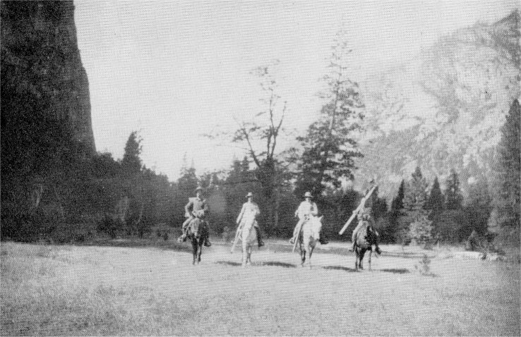
[click to enlarge] U.S.G.S. Camp in El Capitan Meadow, Yosemite Valley, 1906 |
The mapping of the Grand Canyon continued in 1903, and only on January 26, 1904, after nearly two years of practically continuous field work, did Matthes leave by train for Washington. There remained the task of inking the maps and supervising the engraving, eye-straining work which permanently impaired Matthes’ sight. The end products of this labor, however, the Bright Angel and Vishnu quadrangles, stand as examples of topographic excellence which have never been surpassed. Many years later, in 1933, when the geologists participating
[click to enlarge] Yosemite, 1906. F. C. North, F. E. Matthes, F. Austin. and L. V. Degnan |
In June 1903 Matthes interrupted his work at the Grand Canyon to travel by train and stage coach to Yosemite National Park, California. The entry in his tiny diary on Sunday, June 14, reads, “. . . had front seats on stage coming into Valley. First view from Inspiration Point overwhelming.” Though he had gone to Yosemite for a rest, his brief entries for the next four days—the entire duration of his “vacation”—would seem to indicate that his object was not attained. Such a rushing about on foot from the Valley to Glacier Point and Sentinel Dome; to Vernal and Nevada Falls; to the brink of Yosemite Falls and back again to the valley! But of the fact that mind and body were refreshed we are left in not the slightest doubt. He had dreamed of Yosemite ever since coming to America, Now he had beheld it at the height of its springtime beauty, and he was never to forget.
In the winter of 1904-1905, Matthes took a postgraduate course in geology at Harvard University, majoring in geomorphology under Professor William Morris Davis. While at Harvard he also lectured on “topographic field methods for advanced students in geology,” under an Austin Teaching Fellowship. The winter in Cambridge was profitable and stimulating at the University, while, on the outside, there was opportunity for some social life as well as for cultural diversions—lectures, the theater, and music—for which, by this time, he was fairly starving.
Matthes had almost fulfilled requirements for the M.S. degree when there came the offer from the Survey to make a large-scale (1:24,000) map of the Yosemite Valley. This was an opportunity he could not forego, but he inquired if he might not be allowed the few weeks of university work necessary for completion of his course. The reply was negative: the season for field work in the Sierra Nevada was short, and if he wished to undertake the assignment he must start at the earliest possible date. He hesitated no longer. There was but one Yosemite Valley. The chance to map it was worth far more than an additional degree. On June 14 he stood once more in the Yosemite Valley. Camp was set up on the valley floor that afternoon.
If the Grand Canyon had been intricate and involved, the Yosemite Valley was far more difficult to map, for, where the Canyon was all angles and points which were natural “targets” for the triangulator, the valley presented curves and even overhanging arches. Matthes worked out his own system of expressing these features in contour lines, and as he worked his wonder grew that such a diversity of rock forms could be found in so small an area, and that side valleys could hang at such great and varied heights above the main stream. What factors were these that had contrived to produce so amazing a spectacle?
Two seasons were necessary to complete the field work on the Yosemite map. On October 30, 1906, Matthes began inking the map at the Sacramento office of the Survey, and, with the beautiful work of the engravers at Washington completed, in July of 1907 the “Yosemite Special” was an accomplished fact. In 1923 Matthes wrote an interpretative text for the reverse side of this map— one of a number of such essays which, at various times, he wrote for the maps of National Parks and other areas, and which have been greatly appreciated by the general public.
Matthes spent the spring of 1906 at Berkeley, California, assisting Grove Karl Gilbert in a study of the transportation of sediment by rivers, aiding both with the laboratory experiments and by reviewing the extensive Dutch literature relating to silt deposition in the rivers of Holland.
On April 18 occurred the great San Francisco earthquake. Thus it chanced that Gilbert and Matthes were among those who, from the Berkeley Hills, witnessed the conflagration which in the following days spread further disaster through the city across the bay. The earthquake provided more than an unforeseen interruption of their scheduled work. Gilbert was appointed to the California State Earthquake Investigating Commission, and Matthes, assigned to the field almost immediately on behalf of this Commission, traced out and mapped the San Andreas Rift through the northern half of the State. He also made a special detailed map of the rift in the vicinity of Fort Ross, in Sonoma County. His maps were published in the atlas prepared by the Commission, and his field observations, relating particularly to the rift as a geomorphic feature, were embodied in the Commission’s two-volume report.
From 1907 to 1913, Matthes served as an Inspector of Maps for the Geological Survey. The several Inspectors visited their widely scattered field parties during the summer months; in winter, at Washington, they supervised the work of the topographers, as the latter completed the drafting and inking of their field manuscripts. In January 1908 Matthes and four associates founded the Quadrangle Club, for senior topographers; the same month the junior topographers likewise organized, forming the Triangle Club. Richard T. Evans, veteran topographer, recalls that in the winter of 1907-1908 were held the first of the many meetings—frequently three or four a month—sponsored by the Topographic Branch as a whole, or by these clubs, for purposes of instruction, and for the exchange of experiences and views. These meetings (some held at the Cosmos Club) were continued until 1917, when the ranks of the topographers at Washington became depleted during the War.
Matthes was a leading spirit in planning these sessions, and also in giving papers at them. His discourses, according to Evans, “brought us new and stimulating ideas that deepened our understanding and appreciation of the science of topographic mapping.” These ideas were the outgrowth of his own rich experience and of his acquaintance with mapping practices abroad and the current European literature. In his talks he reiterated his firm conviction that “topography is something more than engineering”; it partakes of “an interpretative and synthetic art.” He insisted that “no topographer who would aspire to give maximum value to his work can hope to do so if he lacks an intelligent insight into the nature of land forms.” The lack of such understanding on the part of the delineator “speaks from every line he draws; it betrays itself in the meaningless,

[click to enlarge] François and Edith Matthes on Pinnacle Peak, near Mount Rainier, Washington, August 12, 1911 |
In 1910 came Matthes’ last major field assignment for the Topographic Branch, when he was put in charge of the mapping of yet another National Park, Mount Rainier, Washington. Once more he found himself working among glaciers, in this case the largest number to be found on any peak in the United States, many of them 6-8 miles long and covering, in the aggregate, 48 square miles. In his words, they “radiated like the arms of a great starfish.” The rock cleavers between the glaciers offered a challenge to map maker and mountain climber alike. Inevitably his interest in glaciers and their work received fresh stimulus, and he again wrote several geological papers as the by-products of a topographic assignment.
Matthes made two ascents of Mount Rainier, each time back packing the heavy alidade and other equipment to the summit. On the first ascent, in 1910, he could accomplish little, as subfreezing temperatures and high winds made use of instruments impossible. On the second ascent, in 1911, he did a long day’s work on the summit and made the perilous descent as darkness fell. Because of poor visibility, resulting from bad weather and forest fires, the field seasons of 1910 and 1911 permitted Matthes to complete little more than a fourth of the map (the southwestern part). The remaining part was completed in 1913 by others. The altitude of the mountain could then be determined. It proved to be 14,408 feet, the fourth highest peak in the continental United States.3
On June 7, 1911, François Matthes married Edith Lovell Coyle, a native of Washington, D. C., and a descendant of some of the founders and prominent citizens of the Virginia and Maryland colonies.
Edith Matthes was no stranger to the scientific world into which her marriage brought her, for she had been a librarian’s assistant at the Smithsonian Institution. Among the interests which she and François had in common were love of the out-of-doors and appreciation of the beautiful in nature. Edith’s wonderment and delight never ceased at François’ ability to read nature as an open book, and their walks together, whether in the western mountains, over the sand dunes of Cape Cod, or through the by-paths of Rock Creek Park, at Washington, D. C., drew them together in an ever closer bond. Though never the thorough linguist that her husband was, Edith was well grounded in French and German, and in one other language, alien to François, Russian. Through travel abroad, including a sojourn of nearly two years in the capital of Russia, she had acquired a cosmopolitanism akin to that of his. Most important of the influences she brought into his life were those stemming from warm sympathy and an intuitive understanding of his motivating hopes and purposes, as well as a home life unknown to him during the long years spent in western explorations.
For this bride now began a life very different from the one she had known in Washington and St. Petersburg. Immediately after their marriage, she accompanied her husband to Longmire, Washington, and all that field season shared with him the rigors of camp life on Mount Rainier. She learned to ride a horse and climb mountains, and she sat for long hours on the promontory stations taking down angles and working out elevations so as to permit the one paid assistant to map the streams and trails. In subsequent field seasons, whenever possible, Edith accompanied her husband on his pack-train expeditions, or she took up her abode at the farthest outpost of communications, there receiving the mail, attending to correspondence, and forwarding supplies to the camp. When the work was on the east front of the Sierra Nevada, more accessible by roads, she served unofficially as “chauffeur” of their personal car, specializing, as she put it, “in the business of navigating mountain passes and rutted roads,” —and, it should be added, thereby leaving her husband free to study the landscape. Many an evening she spent in some lonely canyon as darkness fell, waiting in the car for François to come down off the mountains. By agreement the car doors were locked, and beside her on the seat lay the geologist’s pick, her weapon of defense.
Matthes’ concern with geomorphology had grown, year by year, and he had written and lectured extensively in this field. The series of charming geological essays he contributed to the Bulletin of the Sierra Club drew the attention of that organization to his work, especially since it related to the origin of Yosemite Valley, long a controversial question. On July 1, 1913, Matthes was transferred from the Topographic Branch of the Geological Survey to the Geologic Branch. It was the first such transfer to be made, and, though Matthes was now nearing forty, he welcomed the change as one which would enable him to give undivided attention to geologic problems, which by this time had become his primary interest. The many years he had devoted to topographic mapping gave him an unusual and, from many standpoints, an enviable background for the second phase of his career. Indeed, it may even be said that without that background some of his most significant contributions to geology could not have been made.
Matthes’ interest in topographic mapping remained keen throughout his life. In taking geological field notes, as well as in other connections, he always found it most natural to resort to contour lines in depicting land forms. In 1919 he presented a paper before the Washington Academy of Sciences on “Relief Shading on Topographic Maps,” a subject very near his heart and one in which he had long sought to arouse interest. When, eventually, the Geological Survey began publishing shaded topographic maps as standard practice, it was a source of great satisfaction to him.
Shortly before his death, Matthes presented to the Survey Library copies of the topographic maps of Yosemite Valley, and of the Yosemite and Mount Rainier National Parks, which he had shaded in pencil. The members of the map-shading unit of the Survey wrote him on this occasion, to express their appreciation of his skill, which, they held:
. . . despite much effort and study by contemporary advocates of the idea, has yet to be exceeded. It is with wonder and admiration that we, who now carry on this work, look upon the masterful understanding and quality exhibited in your work. . . . We just want you to know that you have real kindred spirits in our group who understand and appreciate what a pioneer you were in this field.
To the spokesman for this group, Matthes sent this message from his sick bed, on May 22, “I have never had a finer letter of appreciation from anyone and I want him to be sure to know how deeply touched I am by it.”
Matthes’ first geologic assignment was to study the origin of the Yosemite Valley and, what was without precedent, to report his findings in language understandable not only to scientists but to any intelligent and interested readers. He could hardly have dreamed, at the outset, how far afield this investigation would take him before he could reconstruct the sequence of dramatic events which had played a part in the making of what he liked to call “The Incomparable Valley.” Not until sixteen years later, in the fall of 1930, did his completed report, the Geologic history of the Yosemite Valley, Professional Paper 160, come off the press. Professor Kirk Bryan,4 in reviewing this most widely acclaimed of Matthes’ publications, wrote, “Occasionally in the history of science there appears a work so excellent, so comprehensive, that it becomes immediately a classic. Such a newborn classic is the long-awaited ‘professional paper’ by Matthes on the Yosemite Valley.”
It is not possible here to summarize Matthes’ great monograph adequately; for that Professor Bryan’s review should be consulted. It may be observed, however, that in Professional Paper 160 Matthes goes far beyond the limitations set by his title, for he interprets the Yosemite Valley in its relation to the geologic history of the entire Sierra Nevada, giving special emphasis to problems of structure, geomorphology, and glacial geology. This he does, as Professor Bryan remarks, “with great breadth of insight and a wealth of detail, largely of a quantitative nature.” It should be added that clues to the genesis of many geomorphic features of the Yosemite Valley, and thereby of other regions in the Sierra, were provided by the detailed petrographic studies of F. C. Calkins, published as a part of the report.
Matthes’ attempt to address the widest possible circle of readers, by reducing to a minimum the use of “scientific jargon,” was so successful that it has been emulated by many other writers; nevertheless, Professional Paper 160 remains the model in its field. It is not surprising, therefore, that the demand for this volume has exceeded that for any other Professional Paper. Copies of the first printing are now coveted by collectors of Californiana. The literary excellence of this work and Matthes’ other writings is remarkable considering his late start in English; however, as he himself once observed, this was not wholly a handicap, for familiarity with other languages made one sensitive to subtle nuances of English which otherwise might pass undetected.
World War I brought Matthes special assignments, such as describing the geologic environments of Camp McClellan, Alabama, and Camp Gordon, Georgia. After the war, in the summer of 1919, the University of California Extension Division sponsored a series of lectures at Yosemite National Park, named after the noted professor, Joseph LeConte. Matthes was invited to present the geologic lectures and gave these on three successive days, July 8-10. The first and third lectures (“The Origin of the Yosemite Valley as Indicated in the History of Its Waterfalls,” and “The Origin of the Granite Domes of the Yosemite”) were given in the government pavilion in the valley, but the second lecture (“The Highest Ice Flood in the Yosemite Valley”) was delivered out of doors to an audience which gathered at Glacier Point, 3200 feet above the valley floor, where use of lantern slides was needless as the landscape itself furnished the illustrations of the theme.5
Professional Paper 160, though a large volume, did not contain all the data which Matthes had gathered in the Sierra Nevada, for from the Merced and Tuolumne basins he had extended his investigations southward into the upper San Joaquin basin and even as far as the Kings Canyon and Sequoia National Park. Through these reconnaissances he had become engrossed in the larger problems of Sierran geology and he was eager to pursue these further.
But there followed the “Mississippi Valley interlude,” from 1928 to 1934, during which he was assigned to geologic problems in the Middle West. These put him far behind in his Sierran work—one reason why a number of his Sierran studies never were finished. In 1933 he did have opportunity to contribute two papers on the Sierra to Guidebook 16, prepared for an excursion of the Sixteenth International Geological Congress; and in 1935, to his great happiness, he was returned to California, this time through a co-operative agreement with the National Park Service, for a reconnaissance of Sequoia National Park. He completed this reconnaissance in 1936 and that summer also made investigations in the northern part of Yosemite National Park. The Sequoia data were urgently needed by the National Park Service, and to meet this need Matthes, pending opportunity to write a formal report, assembled three volumes which summarized the geology of the park by means of annotated photographs. These “Sequoia albums” proved invaluable and eventually, though not until two years after Matthes’ death, were published in book form. Matthes was able to complete only one other major paper on Sequoia National Park, namely, The Geologic History of Mount Whitney, published in 1937.
In 1937 Matthes continued field work in Yosemite National Park and late in the summer began to investigate the east front of the Sierra Nevada. The resulting study he came to regard as the most important of his Sierran work, for it led him to conclude that the great eastern escarpment of the range had been formed as a result of early Pleistocene faulting, and hence was of much more recent origin than had been supposed. In 1938 and 1939 he was able to round out his evidence, at least in part. In July 1939, following meetings of the Cordilleran Section of The Geological Society of America, in Berkeley, where he presented his findings, he led a party, including several interested laymen, into the Yosemite Valley and thence across the range to the eastern escarpment itself, where the evidence could be reviewed on the spot. This was destined to be his last excursion into the Sierra Nevada.
Although in his later years Matthes published many papers, his time and strength were increasingly consumed by the demands of various scientific organizations. As chairman of the Committee on Glaciers of the American Geophysical Union, he organized and supervised a program for conducting co-operative studies and measurements of the existing glaciers in the United States and abroad, a work which made him an international leader in deciphering “the elusive record of pre-historic, post-Pleistocene fluctuations of climate.”6 As a part of this program, he began assembling a collection of dated photographs and other records relating to the existing glaciers in the United States. This file has grown through the years and has become increasingly valuable for reference, revealing the changes in extent and volume which the glaciers have undergone. Also, Matthes prepared detailed reports summarizing and analyzing the data on glaciers, particularly with reference to their year-to-year changes, and these reports were published annually from 1932 to 1946 in the Transactions of the American Geophysical Union.
Matthes returned to Washington in the fall of 1939 at a time of world crisis. Hitler’s hordes had invaded Poland, and the war in Europe was on. Delegates to the triennial assembly of the International Association of Scientific Hydrology were convening in the nation’s capital. When the French secretary abruptly departed for his native land, Matthes—the only available linguist in the American delegation—was drafted to take his place. So he was burdened not only at these meetings but for years afterward with the responsibility for the activities of this group, one of the largest of international scientific organizations. He was also made secretary of the International Commission of Snow and Glaciers, another division of the Association, and this position likewise called for a tremendous amount of correspondence with scientific colleagues throughout the world.
On top of all this, Matthes was invited to write a chapter on glaciers, for

[click to enlarge] |
During World War II, Matthes was called on to make many contributions to the war effort, including the work of the Military Geology Unit of the Geological Survey, by reason of his broad geographic knowledge and his command of foreign languages. In 1945, reluctantly but as a patriotic duty, he undertook a critical re-ëxamination of W. H. Hobb’s doctrine of glacial anticyclones, which he regarded as scientifically untenable and indeed dangerous in that it afforded a false premise for the use of Greenland as an air base. In Part I of this study, published in 1946, he concluded that “there is no evidence of a virtually permanent ‘glacial anticyclone’ centered over the Greenland ice sheet. On the contrary . . . weather over the ice sheet is controlled by alternating cyclonic and anticyclonic movements. . . . Aviators need not expect so much as a fifty-fifty chance of meeting with good weather on flights across central Greenland, except for a few weeks in midsummer.” Part II of this study was completed, after Matthes’ death, by Arthur D. Belmont.
Matthes’ versatility and manifold interests were not unmixed blessings. For instance, many of the innumerable requests for information received by the Geological Survey eventually found their way to his desk for reply. Such interruptions, although oft-times rewarding, were nevertheless distractions from his principal interests and could hardly do other than induce a certain sense of frustration. The brief years slipped away with the growing feeling that there was “so little time, so much to do.”
Because of heavy demands made on the Geological Survey during and after the war, Matthes was continued on the active rolls somewhat more than three years beyond the statutory age of retirement (70 years), but on June 30, 1947, he retired. The summer was spent in Washington, winding up official and personal affairs. Finally, in September, François and Edith drove across the country to the little home in El Cerrito, California, which they had bought for the retirement years.
Matthes gave himself feverishly to the task of arranging his library and professional materials, took vigorous walks over the Berkeley Hills, and worked in the garden to “keep fit.” In February, 1948, with long-deferred writing projects scarcely begun, he was handed a tremendous organizational task: to plan the program of the Committee on Snow and Glaciers for the sessions of the International Scientific Congress, scheduled to meet in August, at Oslo. He felt he would be derelict in his duty if he did not accept this task which, he knew, would require all his time and energies for months to come, but he did so with a heavy heart, seeming to sense that now his hopes for “the retirement years” might never be realized.
In the early morning hours of Sunday, April 18, Matthes was stricken with a heart attack. Nine weeks later, June 21, he died. On June 25, services were held at sunset in the El Cerrito home, high on the Berkeley Hills facing the Golden Gate, and later the ashes of François Matthes were brought to his beloved Yosemite. There, on September 18, in accordance with the wish he had expressed, that which was mortal of François Matthes was committed to “The Incomparable Valley.”7
In the course of his life, recognition came to Matthes from many sources. He was starred in American Men of Science, and he served as president of the Geological Society of Washington in 1932 and of the American Association of Geographers in 1933. The long list of his affiliations with learned societies, mountaineering clubs, and other organizations, both domestic and foreign, can be found in Who’s Who in America, and in American Men of Science, and need not be repeated here. Four honors may be mentioned as representative of the varied facets of his interests and work:
He was decorated Chevalier, Order of Leopold II, by King Albert of Belgium, in 1920, in appreciation of the account which he gave to the King and his party of the origin of Yosemite Valley, when they visited Yosemite in the autumn of 1919. He was awarded the Order of the Silver Beaver in 1931, by the Council of the Boy Scouts of America, for “distinguished service to boyhood.” This was the honor he cherished most dearly. At commencement exercises in the great stadium of the University of California in 1937 he was given the honorary degree of L.L.D. President Robert Gordon Sproul, in conferring the degree upon Matthes, said, in part, “ . . . by your artistry in the delineation of land forms and your clear, scientific description, you have interpreted the beauty of the Western American Landscape to the mind as well as the eyes of all who love the mountains.” Finally, on April 28, 1948, he was awarded the gold medal of the Department of the Interior for 51 years of distinguished service to the United States Government. The citation accompanying the award reached Matthes less than a month before his death, when he was gravely ill but not too ill to experience a glow of happiness when it was shown to him. The beautiful gold medal—a replica of the insignia of the Department of the Interior, showing in the foreground a bison in bas-relief, in the background a chain of mountain peaks silhouetted against the rays of the setting sun—did not come in time.
In 1949 the Sierra Club, which had been ever appreciative of its distinguished honorary vice-president, took measures to give the names “Matthes Crest” and “Matthes Lake” to two suitable geographic features in central Yosemite National Park.8
The place which François Matthes holds in American science is secure and, in certain respects, unique. He stands alone in having attained eminence first as topographer and later as geologist, and he is one of the relatively few whose writings rank as both science and literature. His colleagues held him in highest esteem not only for the originality and importance of his contributions to science but also because they knew him to be, at all times, a gentleman. Those who recall him from professional meetings will not forget the earnestness which distinguished his presentation of papers, his participation in discussions, and his assumption of the responsibilities so often entrusted to him.
Physically and intellectually alike, Matthes was impelled by a tremendous inner drive and tenacity of purpose; and his ideals with respect to workmanship were so high he was never willing to compromise short of the best results he could achieve. He was meticulous with respect to details, and conscientious and orderly to an extraordinary degree—traits well illustrated by his personal diary, which he began with an entry on January 1, 1897, the day he reported for duty in Indian Territory, and continued uninterruptedly for more than fifty-one years. The final entry was made but two hours before he suffered the fatal heart attack.
In speech and manner, François Matthes retained a quaint suggestion of his rich inheritance of old-world culture, which clung to him like a fragrance. There was a certain dignity and courtliness about him; it might be described as a refinement which instinctively expressed itself in innate good taste and courtesy. He was aristocratic, but in the best sense of the word, for there was no snobbery about him. Through a long lifetime, he associated on terms of democratic equality with “all sorts and conditions of men,” from kings to cooks.
François Matthes may have seemed, to some of his co-workers, a shy, almost aloof man; for he quietly went about his affairs, had no time or inclination for “small talk” during office hours, and worked with absorbed intensity at his desk or drafting table. Often he dined alone, seeming to be—as he actually was—deep in thought. But how his face brightened, and how animated his conversation became, when a former field associate called upon him, or someone broached a subject close to his heart!
There were facets to his personality which many colleagues never suspected, and relatively few understood, even among those who knew him intimately in a professional way. He was a highly sensitive person who rarely disclosed his innermost thoughts and feelings, and who, when he did so, could express himself better with pen than in speech. The aesthetic played a dominant part in his life; he was not only a scientist, but a poet, and an artist to the core. To a friend he confided, “I simply cannot be happy unless my work is conducted in country of inspirational beauty.” During the “Mississippi valley interlude” he wrote to W. M. Davis, “I am temperamentally not well fitted for work on the monotonous flats of the Mississippi valley. . . . I should much prefer returning to the mountains and carrying on there as long as I am physically fit,—the more so if, coupled with the mountain work, there should be opportunity for contact with the public.”
Among kindred spirits, Matthes was not shy. Actually, he loved people, especially young people; and in the many years of service he gave to scouting, Sierra Club activities, and the interpretative programs of the National Park Service, he found inner satisfactions which meant much to him. In his personal notes he recurs frequently to a theme expressed thus in one of his letters, “Nothing makes me happier than when I can share the results of my scientific studies with laymen.” Those who knew Matthes only as the serious scholar might have been astonished at the gusto and enjoyment with which, on request, he would address tourists who packed the Yosemite Museum or gathered at an evening campfire to hear him recount the geologic history of Yosemite. He was a born teacher and might have accepted the teaching opportunities that came to him repeatedly had he not found the riddles of Sierra geology irresistibly fascinating. Francis P. Farquhar, California historian and former President of the Sierra Club, has written of Matthes that it was “a rare privilege to be with him and listen to his discourse. He was always glowing with enthusiasm and always eager to impart it to others. The beauty of the earth, particularly of mountains, moved him deeply, for he saw all around him manifestations of the orderly processes of creation.”
In what someone once described as his “beautiful continental hand”—the hand in which he wrote out and painstakingly revised all his manuscripts, and which never lost its beauty or firmness despite the swiftness with which he wrote—Matthes was wont to copy those poems and passages which especially appealed to his thoughtful, beauty-loving, and deeply religious nature. These selections, and thoughts of his own which he jotted down on any piece of paper at hand, as they came to him, reveal the man. Thus, for a paper on Yosemite Valley he wrote a foreword (never published):
There are those who still fear that science will crush religion one hears not a little these days about ‘those Godless scientists.’ But pray, in what way can research of this sort possibly lead away from religion? Is it not, rather, a source of inspiration and spiritual growth which our very ignorance heretofore kept hidden from us? And does it not inevitably enhance our reverence for the Author of the universe?
On the wall of his room there hung, for almost four decades, a framed, illuminated copy of “The Footpath to Peace,” by Henry Van Dyke, one of his favorite writers:
To be glad of life because it gives you the chance to love and to work and to play and to look up at the stars; to be satisfied with your possessions but not contented with yourself until you have made the best of them; to despise nothing in the world except falsehood and meanness, and to fear nothing except cowardice; to be governed by your admirations rather than by your disgusts; to covet nothing that is your neighbor’s except his kindness of heart and gentleness of manners; to think seldom of your enemies, often of your friends, and every day of Christ; and to spend as much time as you can, with body and spirit, in God’s out-of-doors—these are little guideposts to the path of peace.
In one of his notebooks François Matthes printed, with exquisite neatness, this verse by Irene Hardy:
|
I follow the trail
To find truth ere I rest. I follow the trail: Men say I shall fail In this measureless quest To find truth ere I rest. What though I fail? I follow the trail. |
Fritiof Fryxell
Reprinted from Proceedings Volume of the Geological Society of America, Annual Report for 1955, pages 153-168. July, 1956. The sources on which this biographical account is based are given on page 153 of the Proceedings Volume, and a Selected Bibliography of the writings of Dr. Matthes appears on pages 166-168.
1The account here given is summarized mainly from the paper by François E. Matthes and Richard T. Evans, Map of Grand Canyon National Park. The Military Engineer, volume 18, 1926, pages 188-201.
2History and exploration of the Grand Canyon Region: Natural History Bulletin No. 2, Grand Canyon Natural History Association, November, 1935, pages 18-22.
3The altitude of Mount Rainier was resurveyed in the summer of 1956 by a special joint survey party of the U.S. Geological Survey and the National Park Service. As a result, the altitude of Columbia Crest, the highest point on the mountain, was found to be 14,410 feet, rather than 14,408 feet. This left Mountain Rainier in fifth place, a position to which it was dropped in 1955 when a resurvey of Mount Harvard changed the altitude of that mountain from 14,399 feet to 14,420 feet. The order of the five highest peaks in the United States, exclusive of Alaska, is now as follows: Mount Whitney (14,495 feet), Mount Elbert (14,431 feet), Mount Harvard (14,420 feet), Mount Massive (14,418 feet), and Mount Rainier (14,410 feet). With the exception of Mount Whitney in California and Mount Rainier in Washington, these peaks are all in Colorado. (Appalachia, December, 1956, page 239.)
4Journal of Geology, volume 40, 1932, pages 84-87.
5The LeConte Memorial Lectures were never published, as intended, but Matthes’ contributions were in part included in Professional Paper 160 and in part published many years later (1910) in the posthumous volume, The Incomparable Valley.
6Citation accompanying the Department of Interior honor award for distinguished service, with gold medal, conferred on François Matthes in April, 1948. The citation is published in the Sierra Club Bulletin, volume 33, 1948, page 8.
7François’ twin brother, Gerard, outlived him by eleven years. His death occurred on April 8, 1959. “Memorial to Gerard Henrik Matthes, A Reclaimer of Rivers” (28 pages), by David E. Donley, was privately published by Mrs. Gerard H. Matthes in March, 1960. It includes a Selected Bibliography. A two-page abstract of this Memorial, prepared by Mrs. Gerard H. Matthes, was published by the American Society of Civil Engineers, as Memoir No. 2255.
8Moran, Reid V., Matthes Crest. Sierra Club Bulletin, volume 34, 1949, pages 110—111 An illustration of Matthes Crest appears in this volume, page 76.
Next: Winds of the Yosemite Valley • Contents • Previous: Table of Contents
| Online Library: | Title | Author | California | Geology | History | Indians | Muir | Mountaineering | Nature | Management |
http://www.yosemite.ca.us/library/matthes/francois_matthes.html